
Connected but distinct
We know that each of the existing communities around the development wants to maintain their culture and identity. We are committed to embedding that into the plans for Bowmans Cross. Part of this will be through significant Green Belt secured within the design and additional green spaces set out in the landscape strategy.
We also know that transport is one of your biggest concerns, and that access to services and facilities can be a major challenge. So, we want your input to get that balance right.
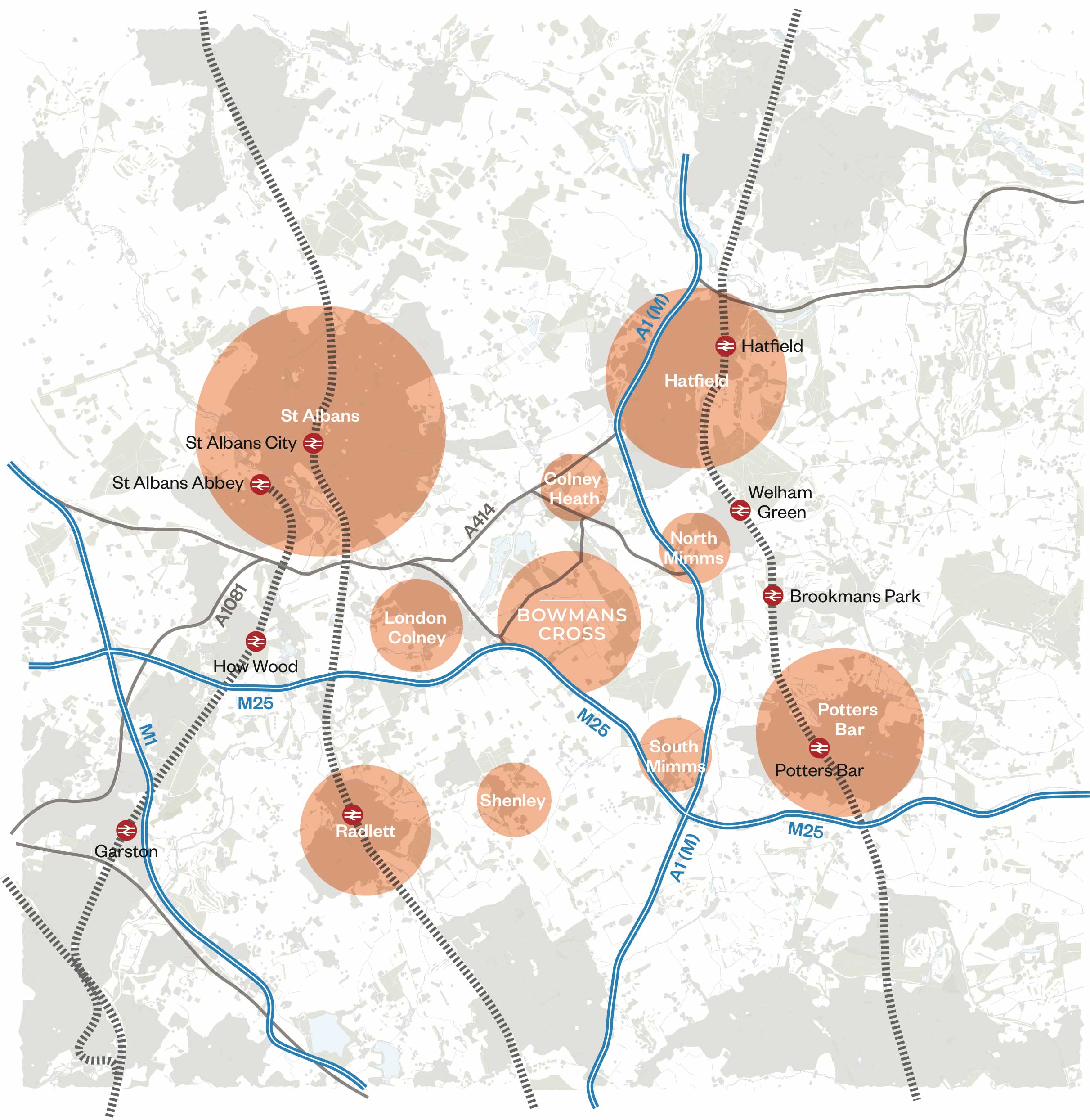
There are eight rail stations within bus and bike distance of Bowmans Cross
Well connected
Bowmans Cross has all the key foundations of a sustainable development location, with good connections to local public transport networks and the opportunity to invest in active travel routes to help connect to nearby places sustainably. Our strategy is to reduce the need to travel by providing everything you need on your doorstep, and then to ensure transport choices are car-last not car-first.
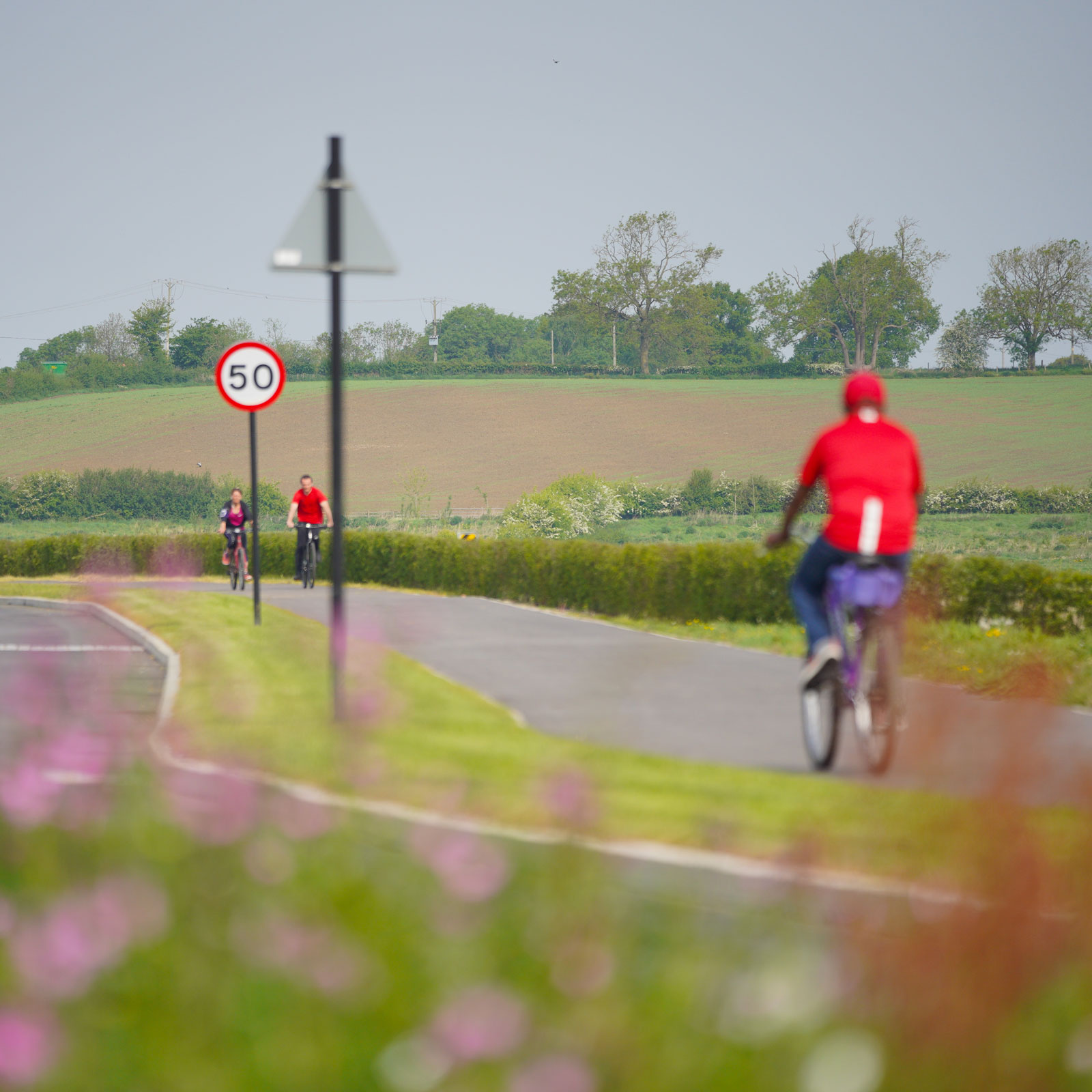
Pedestrian and pedal power
Bowmans Cross will be designed to encourage walking and cycling, with a network of footpaths and cycleways throughout the development and along a redefined Coursers Road spine route. These will connect to key destinations onsite including schools, district centre, local centres, transport hub and employment opportunities.
Routes will include segregated cycleways along all primary roads, traffic-free routes within green corridors and on-carriageway cycling on quieter residential roads.
Off site: For journeys further afield, there is an opportunity to create a new network of walking and cycling routes by plugging gaps in the existing infrastructure, providing connections between key destinations, and significantly improving links throughout the local area. This new network would benefit both existing and future residents.
Active modes of transport
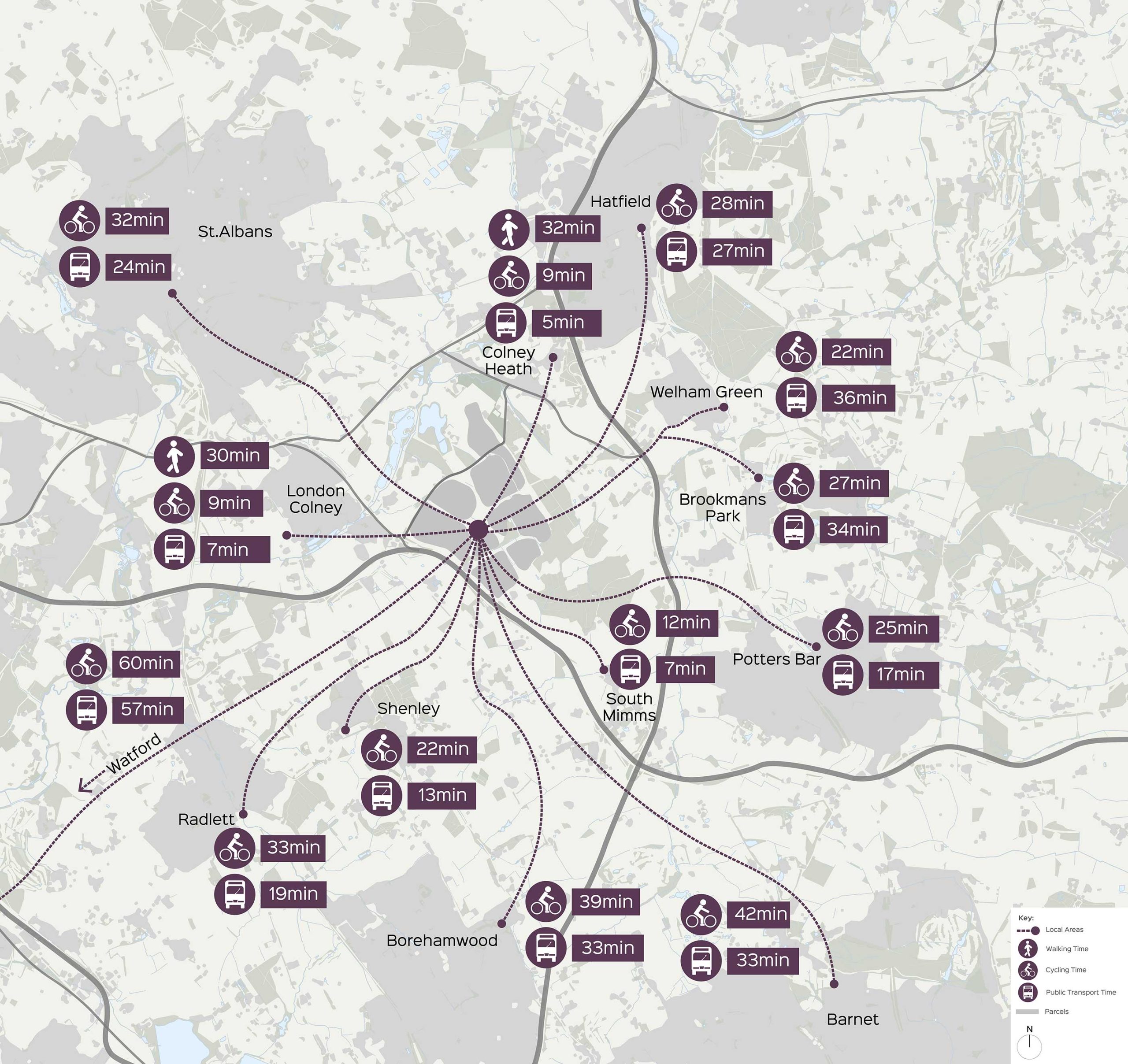
Journey times
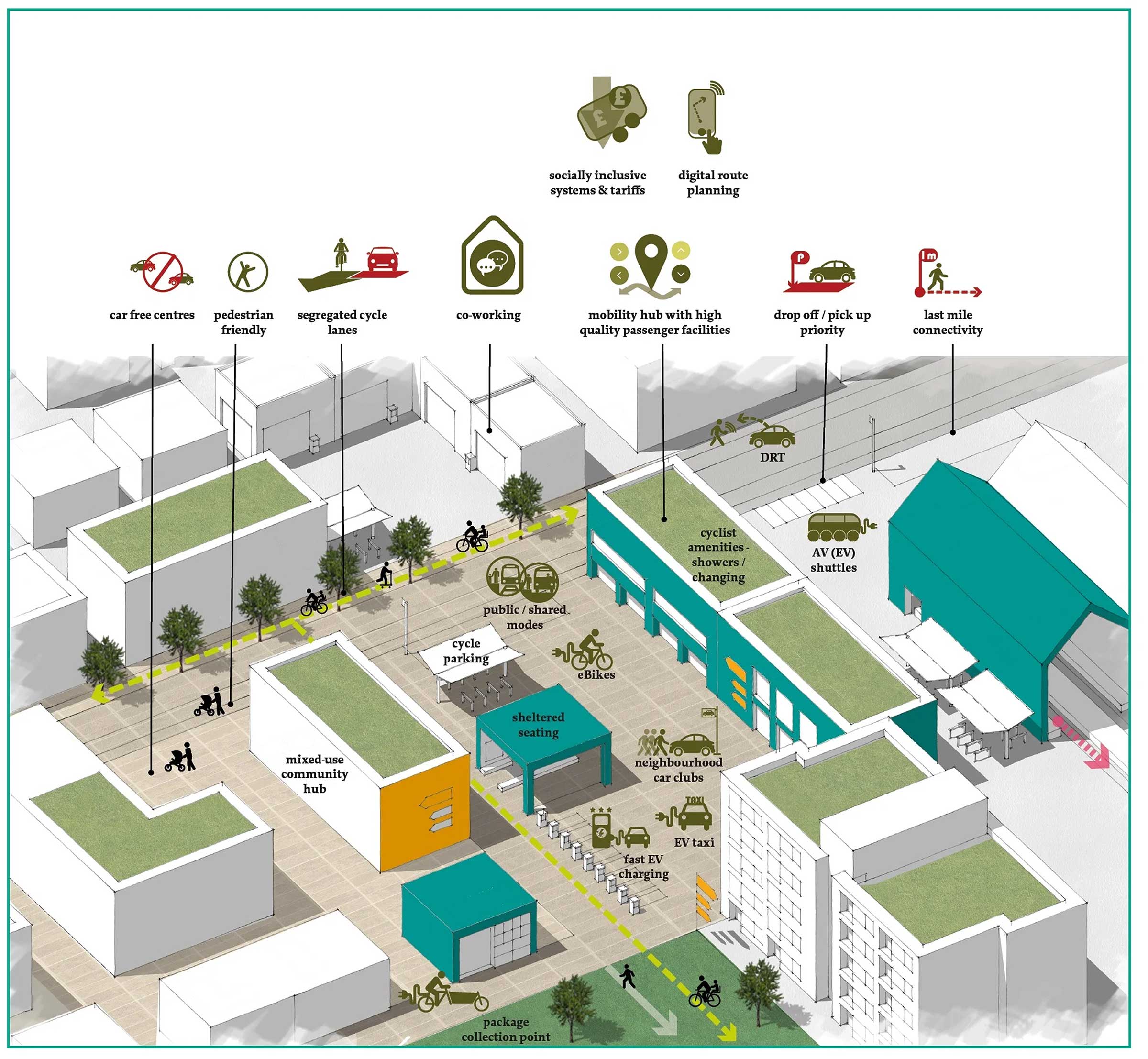
Sustainable Transport Hub
Our vision is to provide low carbon and active ways of getting about. A Sustainable Transport Hub at Bowmans Cross will provide advice, support and connections so residents and people from across the area have information and access to more sustainable modes of transport; so they choose the car as the last option, not the first.
The hub will include:
- travel advice and incentives for choosing public transport or active travel
- connections across the local bus network
- cycle parking and repair areas
- cycle and e-bike hire schemes
- car hire and car club facilities
- parcel drop off and pick up